Syria Soil
A general soil map of Syria 1:1,000,000 has been prepared by ACSAD (1985) using the U.S.D.A. Soil Taxonomy (1975) as a classification system. The soils of Syria are represented by the following five orders :
Aridisols
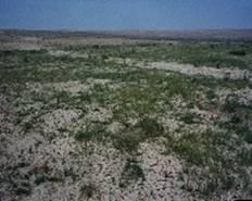
Aridisols are the most extensive soils in Syria, having aridic moisture regime. They predominate about 54 % of the country :
-Calciorthids : They dominate the larger part of soils with aridic moisture regime. They cover about 21 % of the country dominating about 30 % of the total area. They are mainly spreaded in the southeastern part of Syria including all the Syrian part of the Hamad plateau and most part of Syrian steppe (the Badiah). They are also the prevailing soils in some areas in the northeast, northwest and the large part of the Bichri mountains.
-Gypsiorthids : They are the most extensive soils in the northeastern part of the country. About 21 % of the soils are gypsiorthids of xeric soil moisture regime. They cover most of the Mesopotamian foredeep, all terraces of the Euphrates, Khabour and Balikh rivers and extend to a considerable distance south of the meridional course of the Euphrates in the Syrian desert and Al-Risafa steppe.
-Camborthids : They cover only 3 % of the country. They are mainly formed by colluvial and to less extension alluvial deposits of the Quaternary age.
- Salorthids : They are mainly restricted to some steppe depressions with high saline ground water table, near Palmyra and along the border with Iraq. Salinity became a serious problem in the highly productive flood plains of the Euphrates river and to less extension the Khabour river. That is due to wrong irrigation practices. Salorthids were estimated to occupy 25 % of the Euphrates flood plain. As whole they cover about 1 % of the country.
Inceptisols
apart from few volcanic ash soils, the Inceptisols of Syria are entirely represented by Xerochrepts, which are the most extensive soils in the country. They cover about 24 % of the total area. They are widely spreaded along the northern border with Turkey and form the transition between the Xerothents of the coastal mountains on the west and the arid soils to the east. They cover the southwestern part completely. The Xerocherpts of Syria are represented by six sub-groups of which Calcixerollic Xerochrepts has the largest extension.
Versoltis
These soils occupy 1 % of the total area. As prevailing soils, they are found on the extreme northeast and northwest of the country, where the rainfall exceeds 500 mm. They are also present as major and minor associations, mainly with the Xerochrepts. In the landscape, the Vertisols are always restricted in the lowered localities.
Entisols
The Entisols are represented by about 14 % of the soils of Syria. Torriorthents and Xerorthents are the main soils within the order of Entisols. Torrifluvents and Xerofluvents have a lesser extension :
- Torriorthents : They are mainly represented by the lithic Torriorthents which occupy about 7.5 % of the country. They are mainly related to the Palmyrides chain.
- Xerorthents : The Xerorthents and mainly the Lithic Xerorthents one cover about 5.7 % of Syria. They are chiefly combined to the western mountains, smaller units are also found along the northern Euphrates valley and Jabal Abd Al-Aziz on the northeast.
- Torrifluvents : They cover about 1.3 % of the country. They are mainly related to the Euphrates and Khabour flood plains and to less extension to some steppe Khabras.
-Xerofluvents : They occupy small areas on the upper Khabour valley and along the course of the Orontes river on the west
Mollisols
it dominates only 1 % of the country. It is mainly found in the areas of the highest humidity in Syria. they are chiefly represented by the Haploxerolls and to a very limited extension Calcixerolls. They prevail on the coastal plain where the rainfall exceed 800 mm.
Non Soils : The non soils surface in Syria are represented by rock-out-crops and to a lesser extension by water bodies. The latter cover about 0.5 % of the country, while the rock out-crops dominated only about 1.1 % on the south-west, they cover about 4 % of the total area.