
Climate and Topography
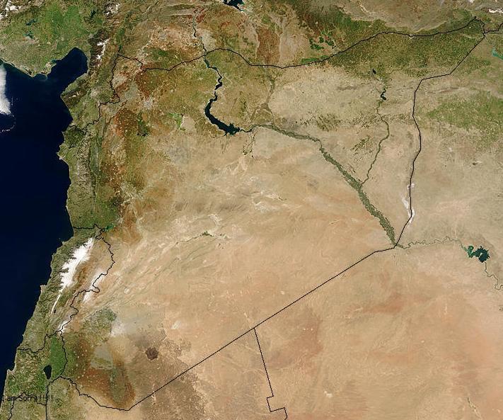
Syria is a part of the Middle East with a total area of about 185 000 km. It lies to the East of the Mediterranean Sea, with 183 km of coastal borders, bounded by 32 19 and 37 20 N latitudes and 35 43 and 42 25 E longitudes. Hermon is the highest mountainous summit of the country, it elevates to 2814 m. Peaks above 2000 m are quite common in the Syrian eastern slopes of Anti-Lebanon mountain. The lowest part of the country lies at the foot of the Golan heights reaching -200 m at the Tiberian Lake of Syrian Golan heights.
Rainfall
The climate of Syria is of the Mediterranean type, which is an extratropical climate with rainfall concentrated in the cool or relatively cold seasons of the year. Summer, the hottest season, is dry. The effect of latitude manifests itself by the abrupt north to south decrease of the annual amount of rainfalls. Hence, within a range of about five latitudinal degrees, the annual rainfall drops from about 1000 mm in the North and Northwest to less than 100 mm in the Southeast of the country.
Temperature
Temperature is highly affected by the topography and the latitude of the different parts of the country. In general, temperature increases from North to South, where the mean annual temperature rises from just below 13d C in the N-NW to approximately 19d C in the S-SE of the country. Syria is a warm country, whereas the mean annual temperature does not fall below 11d C even on the mountain peaks. Air temperatures are affected by such factors as solar radiation, air masses, topography, and type of earth surface. Temperatures decrease with increasing elevation. With the exception of mountainous areas, the coastal area is milder in winter and cooler in summer than the rest of the country. The eastern and southeastern parts of Syria are warmest in winter while the eastern and northeastern parts are hottest in summer. January is the coldest month of the year; August is the hottest month in the summer. The continental influence causes greater difference temperatures between summer and winter in the interior of the country where temperatures below zero are frequent almost every year. The mean minimum temperatures of the coolest month (January) and the mean maximum temperatures of the warmest month (August) varies greatly from a region to another according to the proximity to the sea, altitude, exposition etc.., giving the Syrian climate its particularity.
Bio-climatic Subdivision
According to the pluviothermic quotient of Emberger Syria has the entire range of the Mediterranean climate from the super humid to the very arid (Table 3). The country had been subdivided into different bioclimatic ranges these are:
Humid Mediterranean
The value of the Emberger quotient (Q) is more than 100, i.e. the mean annual rainfall is at least 800 mm. The region comprises Lattakia, Tartous and partly Qunietera and Hama. This region includes two main stages of the vegetation type:
* Lower stage: where the dominant type is a more or less degraded evergreen oak forest: Quercus infectoria, Q. calliprinus, Pistacia lentiscus, Fraxinus ornus., Pinus brutia and Pinus pinea.
* Upper stage: consists of oak juniper forest with cedar and Fir stage between 1400 2000 m and sub-alpine stage above 2000 m with Juniperus excelsa mostly (Nahal, 1962; Barbero et al, 1976; Chalabi, 1980).
Sub-humid Mediterranean
The Emberger quotient (Q) lies between 40 and 90. This region consists of the coastal plains and foothills of Lattakia, Tartous, Goulan heights and Qunietera, with mean annual rainfall that varies between 600 and 800 mm.
The main vegetation type is degraded oak steppe forest type, where the most dominated species are Quercus calliprinus, Q. ithaburensis and Pistacia palaestina.
Semi-arid Mediterranean bioclimate
The Q values are varying between 15 and 40 and the annual ranges between 400 and 600 mm.
The region consists of the plains and isolated mountainous formations lying within Aleppo, Idleb, Hama, Homs, Damascus, Al-Hasakeh and Swieda provinces which form a part of the Fertile Crescent. The vegetation is composed of grasses (Poaceae), with legumes (Fabaceae) and more or less tree species of Pistacia, Crataegus and Amygdalus with bushes of Quercus and Juniperus.
Arid Mediterranean bioclimate
The values of (Q) lie approximately between 12 and 15 in the cool and warm varieties and the mean annual precipitation ranges between 200 and 350 mm.
The region consists of plains and low hills that called the marginal lands, bisected by the Euphrates River, the following provinces are included within this region, S. of El-Hasakeh, N. of Deir Ezzor, Raqqa, Aleppo, Idleb, Hama, Homs, Damascus and Daraa.
The vegetation of this region consists of grasses (Bromus, Aegilops, Hordeum, Vicia and Avena) with woody Astragalus species and shrubs of Salsola, Atriplex, Haloxylon and Artemisia.